GIS Map
Layered maps support the configuration of various GIS maps, including light, dark, Baidu Map, Amap, and other map themes. 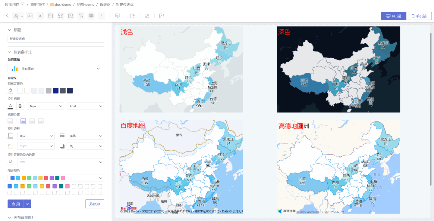
The styles of the light and dark map themes are fixed, while Baidu Map and Amap include multiple styles. 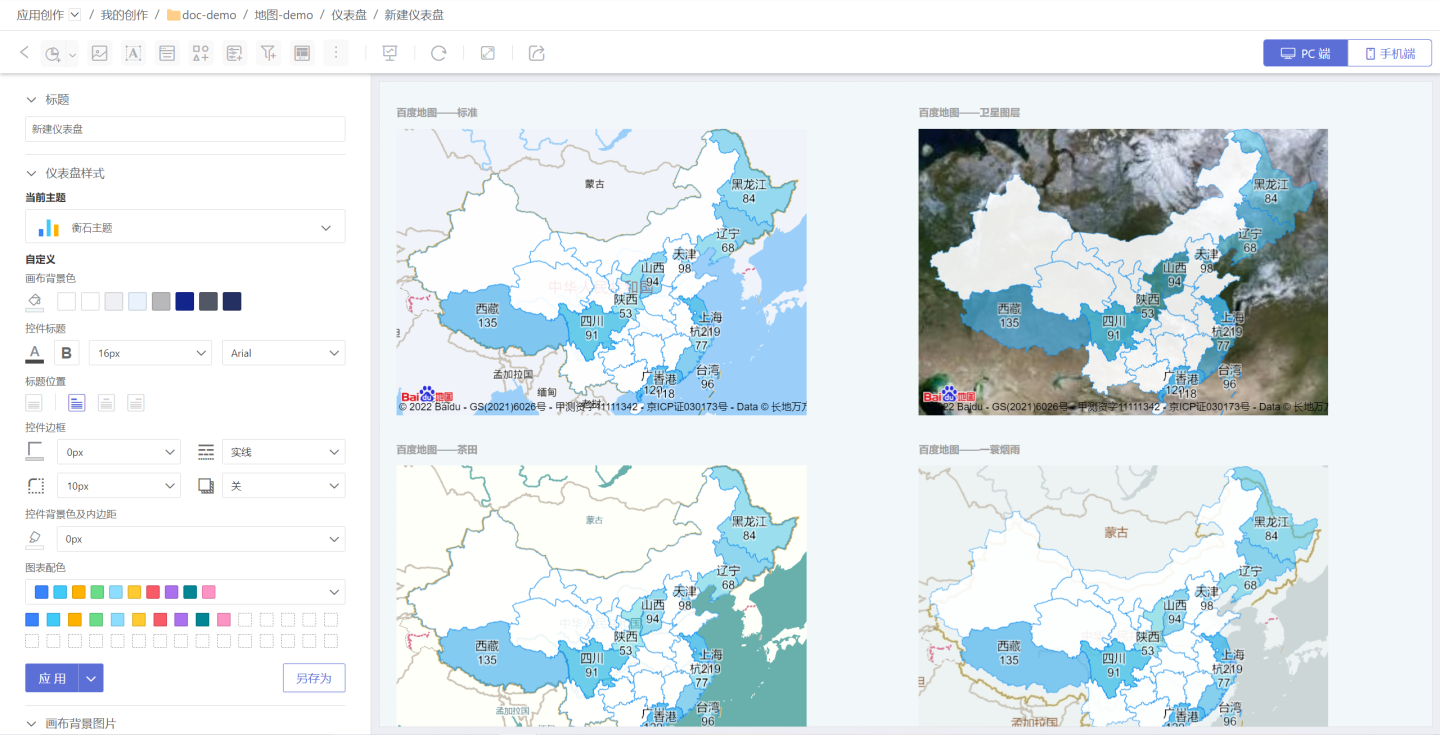
GIS maps enrich the map display styles. The light and dark themes are built-in and require no configuration. Baidu Map and Amap need to be configured before use. 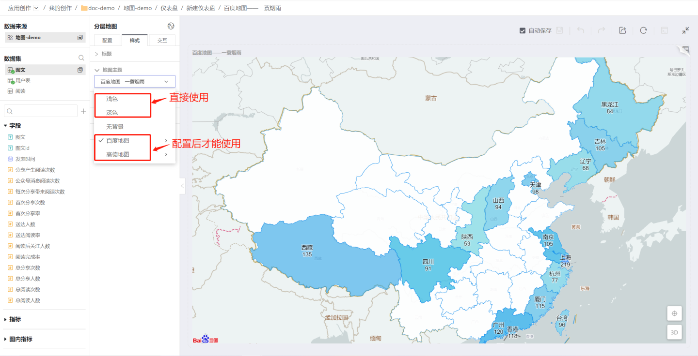
Configure GIS Maps
The following section explains how to configure Baidu Maps and Amap (Gaode Maps).
Configure Baidu Maps
Go to Settings -> Feature Configuration -> GIS Map, select Baidu Maps, enable the map service, then enter the map service key you applied for. After clicking Save, you can start using Baidu Maps. 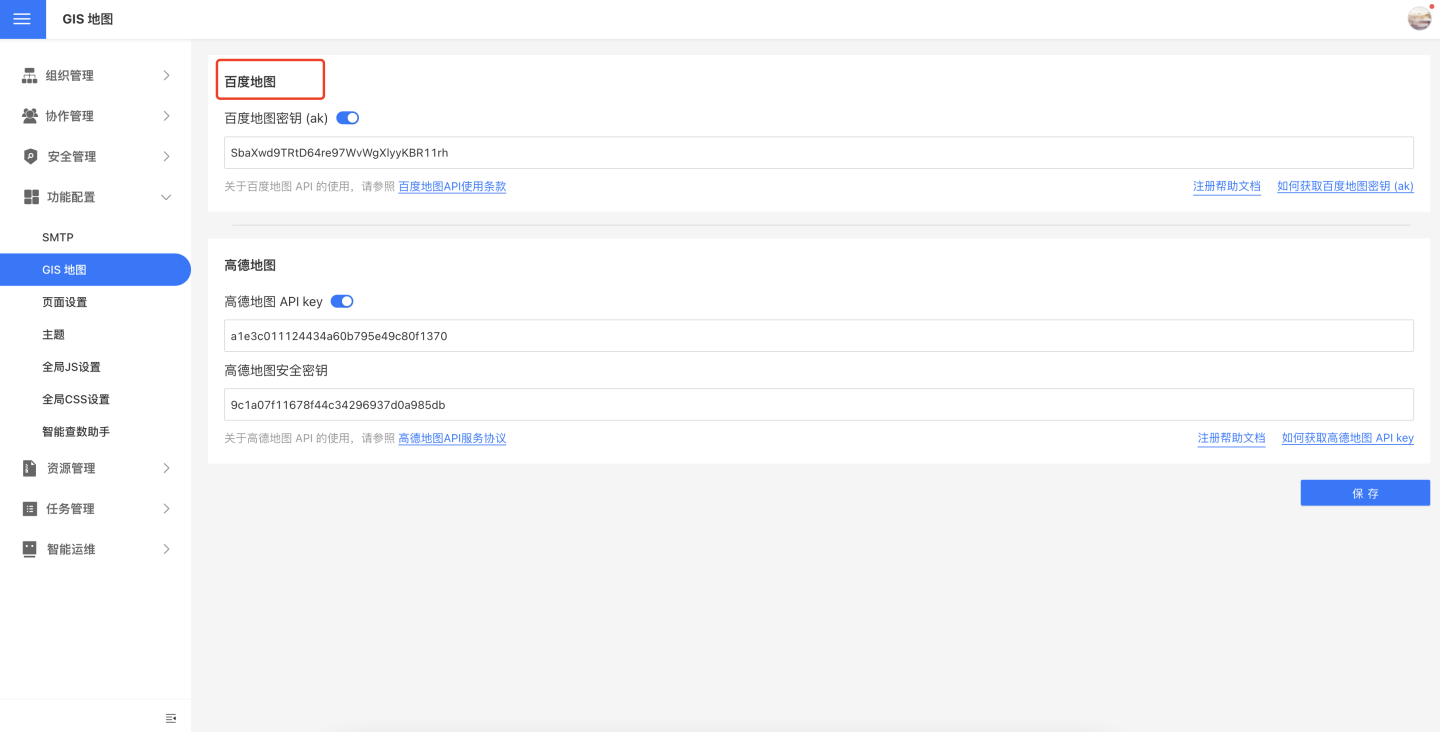
Applying for a Baidu Map API Key
Please refer to the instructions in How to Obtain an API Key for the process of applying for a Baidu Map API key (ak).
When applying for the API key (ak), please pay attention to the Application Type and Enabled Services options. For Application Type, select "Browser". For Enabled Services, please check all options. 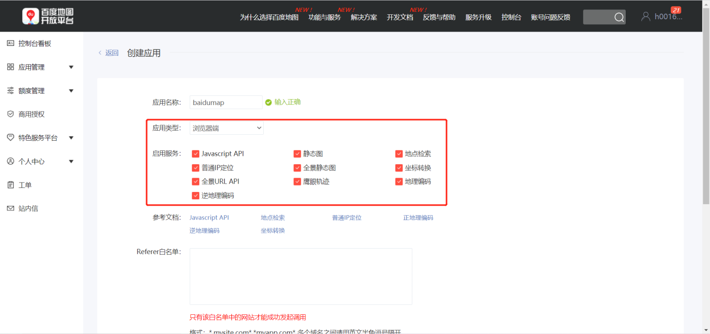
Tip
Before applying for the API key, please read the Baidu Map API Terms of Use. For any non-commercial applications, you may use the API directly. For commercial applications, please refer to the Usage Notice.
Configure Amap
Go to Settings -> Feature Configuration -> GIS Map, select Amap, enable the map service, then enter the Amap API key and Amap Security Key. After clicking Save, you can start using Amap. 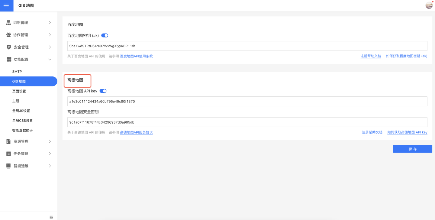
Apply for Amap API Key
Please follow the instructions below to apply for an Amap API key and security secret.
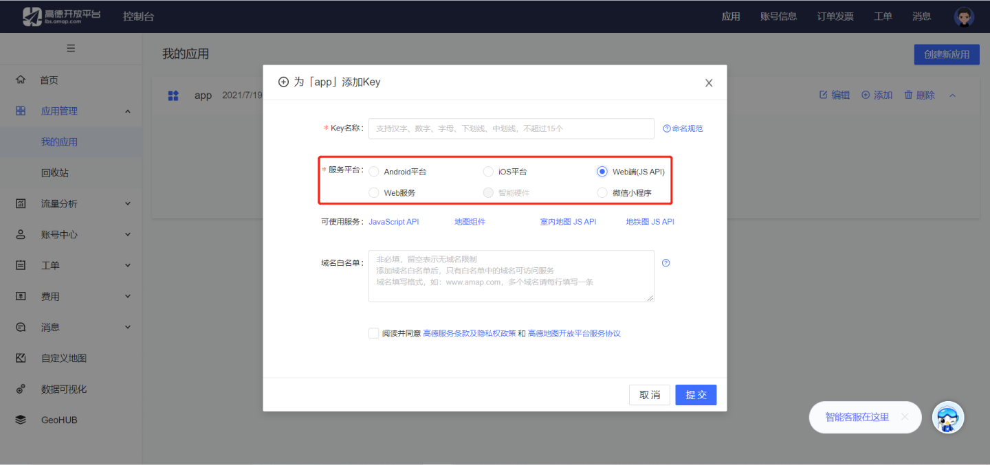
- Refer to the guide on How to Obtain an API Key to apply for an API key. During the application process, please note that the Service Platform type can only be set to "Web (JS API)".
- After successfully applying, please enter the key and security secret into System Settings -> GIS Map.
Note
Before applying, please read the Amap API Terms of Use. For any non-commercial applications, you may use it directly. For commercial applications, please refer to the Amap Open Platform Commercial Authorization Agreement.
Map Zoom
GIS maps support zoom functionality. After enabling the Map Zoom feature in Interaction, users can zoom in or out on the map layers on the PC by scrolling the mouse wheel. On mobile devices, users can zoom in or out using pinch gestures. 
Map Panning
GIS maps support panning. On PC, you can move the map by clicking and dragging with the left mouse button. On mobile devices, you can move the map by dragging with two fingers.